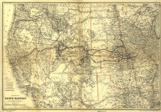
Map showing the Pacific Railroads and their branches; prepared for the United States Pacific Railway Commission. Map of the western United States showing relief by hachures, drainage, cities and towns, Indian reservation, military posts, and the railroad network with main lines color coded. Red indicates lines “aided by U.S. Bonds.” G.W. & C.B. Colton & Co. CREATED/PUBLISHED New York, [1887] Scale ca. 1:3,800,000.


