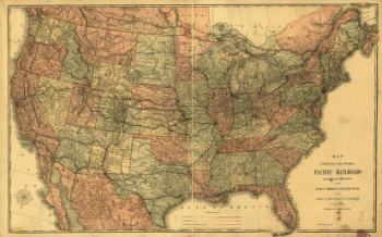
Map showing the line of the Toledo, Wabash, & Western Railway Company and its connections. General map of the midwestern states with drainage, cities and towns, and the railroads with emphasis on the main line. Includes an advertisement for bonds. G.W. & C.B. Colton & Co. CREATED/PUBLISHED New York, 1873. Scale ca. 1:3,750,000. (map)

Toledo, Wabash, and Great Western Railroad
$17.95 – $47.95
SKU: rrsz40
Related products
-

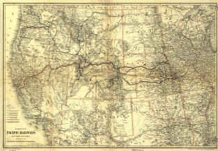
Union Pacific Railroad Company
$17.95 – $47.95 -
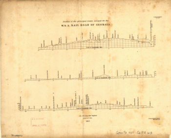
Western and Atlantic Railroad Company
$17.95 – $47.95 -
Union Pacific Railway Company
$17.95 – $47.95 -
Winchester and Potomac Railroad Company
$17.95 – $47.95