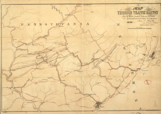
Map of the Through Traffic Railway from the middle & southern anthracite coal fields of Pennsylvania to New York via Perth Amboy; Jesse L. Hawley under direction of R.A. Wilder. Outline map of eastern Pennsylvania and part of New Jersey showing relief by hachures, major drainage, major cities, and the connections of the many tributary railroads serving the coal regions. Railroads are named along the lines. Hawley, Jesse L. CREATED/PUBLISHED Pottsville, Pa., 1868. Scale ca. 1:350,000.


