Map of the Philadelphia, Easton & Water Gap Rail Road. Lithy. of A. Kollner. Outline map of the northeastern United States showing drainage, cities and towns, and the railroad network. Chartered April 8, 1852. Name changed to North Pennsylvania Rail Road. Kollner, Augustus, b. 1813. CREATED/PUBLISHED Phila[delphia], 1852. Scale ca. 1:1,200,000.
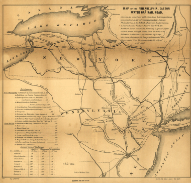
Philadelphia, Easton and Water Gap Railroad Company
$17.95 – $47.95
SKU: rrpr47
Related products
-

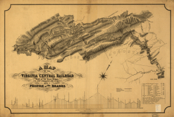
Virginia Central Railroad Company
$17.95 – $47.95 -
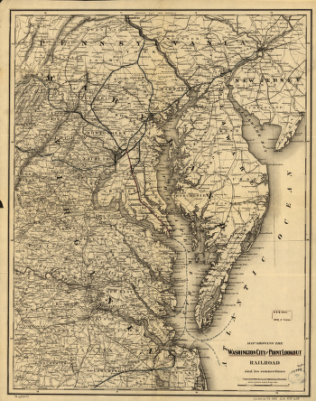
Washington City and Point Lookout Railroad
$17.95 – $47.95 -
Virginia Central Railroad Company
$17.95 – $47.95 -
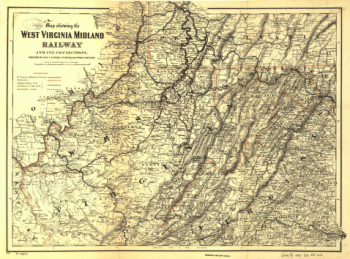
West Virginia Midland Railroad
$17.95 – $47.95