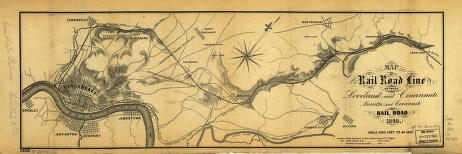
Map of rail road line between Loveland and Cincinnati; Marietta and Cincinnati Rail Road. Physical map of part of Hamilton County, Ohio, showing relief by hachures, drainage, the location of the main line, and other operating and proposed lines, roads, cities, and towns. Reorganized August 1, 1860. Jenney, W. L. B. CREATED/PUBLISHED [n.p.], 1860. Scale ca. 1:60,000.


