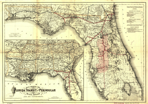
Maps showing the Florida Transit and Peninsula Rail Road and its connections. Maps of southern United States. Main map covers Floria and vicinity and indicates drainage, cities and towns, township and county boundaries, railroads, and the land grant in central Florida. General map shows connections to southern and Gulf states. G.W. & C.B. Colton & Co. CREATED/PUBLISHED New York, 1882. Scale 1:1,140,000 and 1:3,800,000.


