Mary's Railroad. Map showing the Washington & St. Mary's Railroad and its proposed connections north, south, east and west. Middle Atlantic states showing relief by hachures, drainage, counties, cities and towns, roads, and railroads with the main lines emphasized. G.W. & C.B. Colton & Co. CREATED/PUBLISHED New York, 1887. Scale 1:760,320.
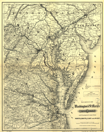
Washington and St
Price range: $39.95 through $69.95
SKU: rrsz68
Related products
-

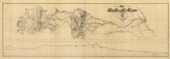
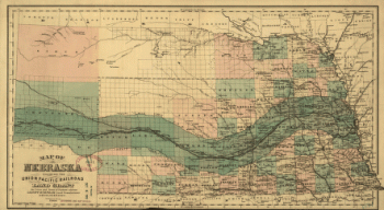
Union Pacific Railroad Company
Price range: $39.95 through $69.95 -
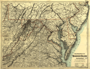
Washington and Atlantic Railroad
Price range: $39.95 through $69.95 -
Western and Atlantic Railroad Company
Price range: $39.95 through $69.95 -
Union Pacific Railroad Company
Price range: $39.95 through $69.95