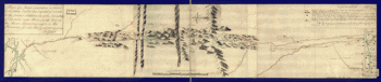
Montresor, John, 1736-1799. CREATED/PUBLISHED [1761?] NOTES Scale ca. 1:390,000. Manuscript, pen-and-ink and watercolor. Mounted on cloth backing with reinforced edges. Relief shown pictorially. Shows campsite locations for the author's expedition from Quebec into Maine.
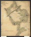
A map of the sources of the Chaudière, Penobscot, and Kennebec rivers, by Montresore
$17.95 – $47.95
SKU: rwcaar083800
Related products
-

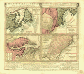
Dominia Anglorum in America Septentrionali
$17.95 – $47.95 -
Plan of a route undertaken in winter, Jan 26th
$17.95 – $47.95 -
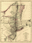
A map of the provinces of New-York and New-Yersey
$17.95 – $47.95 -
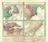
Dominia Anglorum in America Septentrionali
$17.95 – $47.95