12" x 18"
-
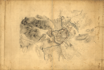
![Battle-field of Chickamauga. [Sept 18-20, 1863]. Wells, Jacob](https://www.ushistoricalarchive.com/wp-content/themes/savoy/assets/img/placeholder.png)
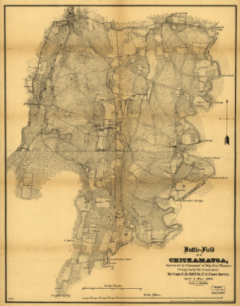
Battle-field of Chickamauga. [Sept 18-20, 1863]. Wells, Jacob
$17.95 – $47.95 -
Battle-field of Gaines's Mill
$17.95 – $47.95 -
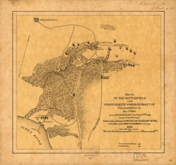
Battlefield and Confederate works in front of Williamsburg, Va
$17.95 – $47.95 -
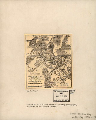
Battlefield in front of Franklin
$17.95 – $47.95 -
Battlefield in front of Franklin
$17.95 – $47.95 -
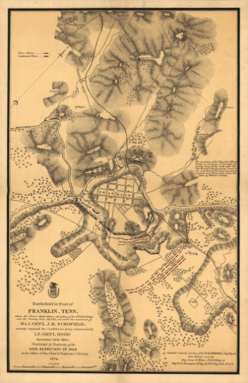
Battlefield in front of Franklin, Ten. November 30th, 1864
$17.95 – $47.95 -
Battlefield in front of Franklin, Ten. November 30th, 1864
$17.95 – $47.95 -
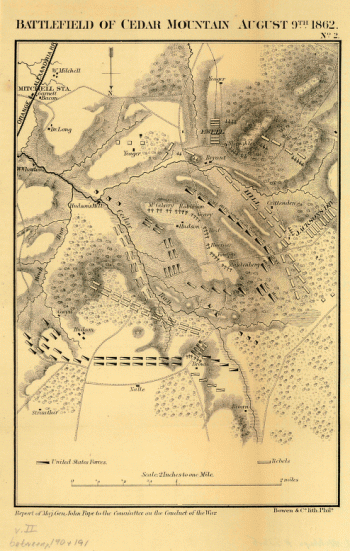
Battlefield of Cedar Mountain, August 9th, 1862
$17.95 – $47.95 -
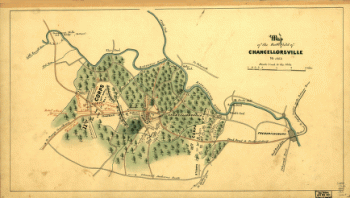
Battlefield of Chancellorsville, Va. 1863
$17.95 – $47.95 -
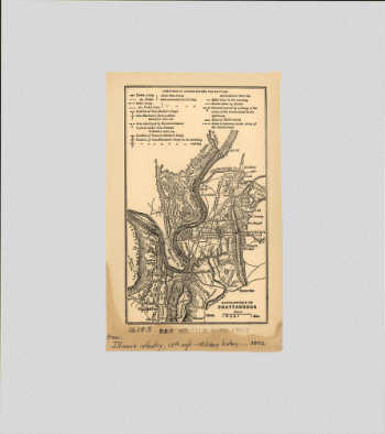
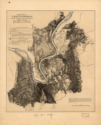
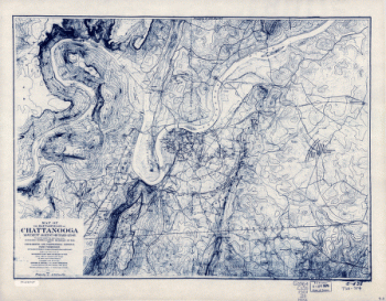
Battlefield of Chatanooga
$17.95 – $47.95 -
Battlefield of Chattanooga
$17.95 – $47.95 -
Battlefield of Franklin, Tenn.
$17.95 – $47.95 -
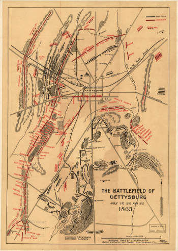
Battlefield of Gettysburg
$17.95 – $47.95 -
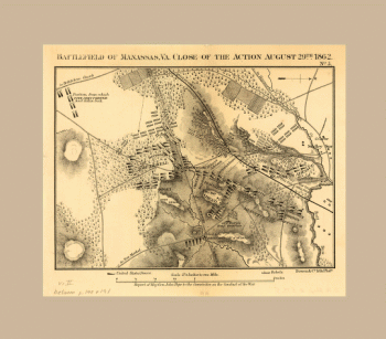
Battlefield of Manassas, Va.
$17.95 – $47.95 -
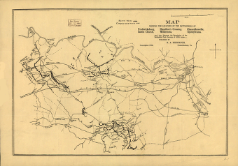
Battlefields of Chattanooga, movement against Orchard Knob
$17.95 – $47.95 -
Battlefields of Chattanooga, movement against Orchard Knob
$17.95 – $47.95 -
Battlefields of Virginia
$17.95 – $47.95 -

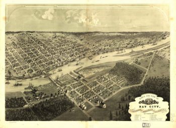
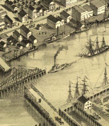
Bay City MI 1867
$17.95 – $47.95 -
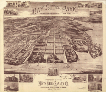
Bay Side Park, 3d ward, borough of Queens, New York City.
$17.95 – $47.95 -
Bay Side Park, 3d ward, borough of Queens, New York City.
$17.95 – $47.95 -
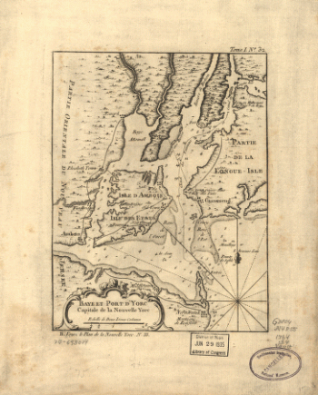
Baye et port d'Yorc, capitale de la Nouvelle Yorc.
$17.95 – $47.95 -
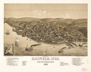
Bayfield WI 1886
$17.95 – $47.95 -
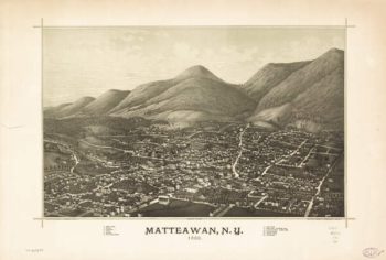
Beacon NY 1886
$17.95 – $47.95 -
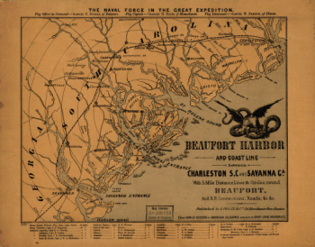
Beaufort Harbor and coast line between Charleston and Savannah
$17.95 – $47.95 -
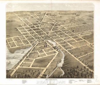
Beaver Dam WI 1867
$17.95 – $47.95 -
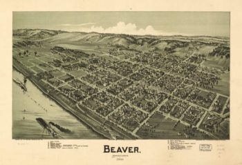
Beaver PA 1900
$17.95 – $47.95 -
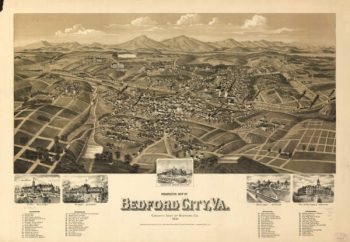
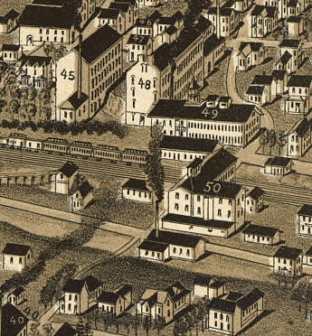
Bedford VA 1891
$17.95 – $47.95 -
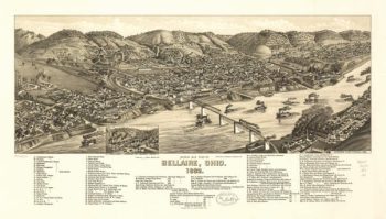
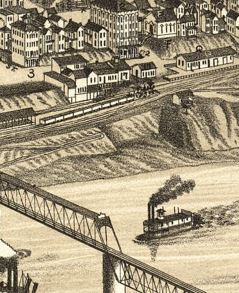
Bellaire OH 1882
$17.95 – $47.95 -
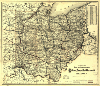
Bellaire, Zanesville & Cincinnati Railway
$17.95 – $47.95 -
Belle Center OH 1875
$17.95 – $47.95 -
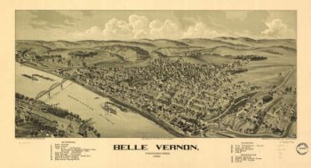
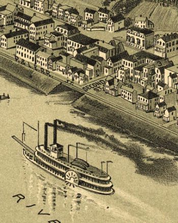
Belle Vernon PA 1902
$17.95 – $47.95 -
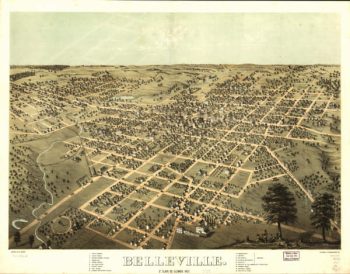
Belleville Illinois in 1867
$17.95 – $47.95 -
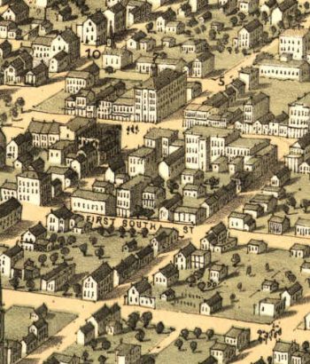
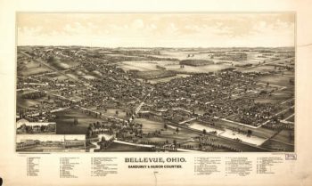
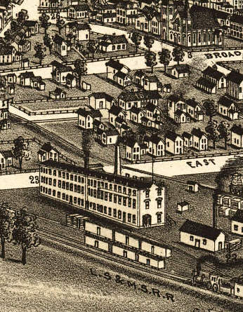
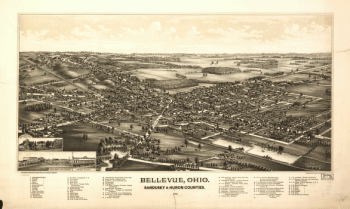
Bellevue OH 1888
$17.95 – $47.95 -
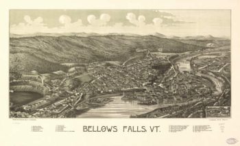
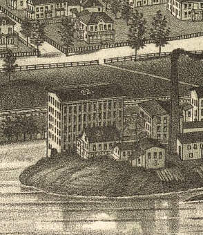
Bellows Falls VT 1886
$17.95 – $47.95 -
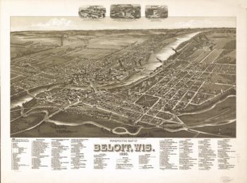
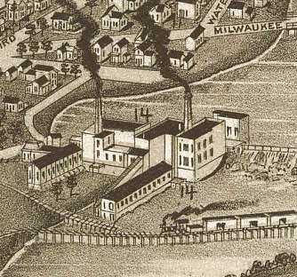
Beloit WI 1890
$17.95 – $47.95 -
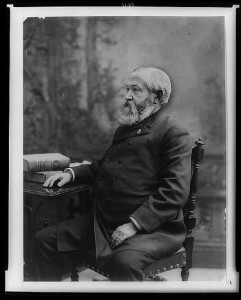
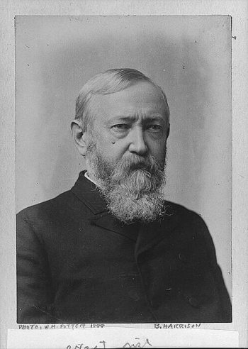
Benjamin Harrison
$17.95 – $47.95 -
Benjamin Harrison
$17.95 – $47.95 -
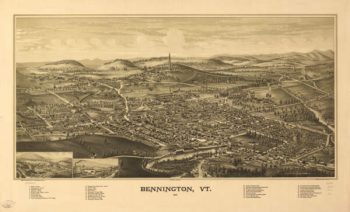
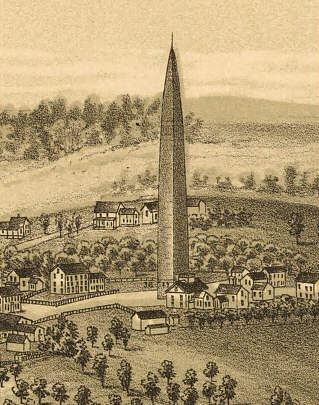
Bennington VT 1887
$17.95 – $47.95 -
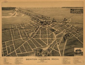
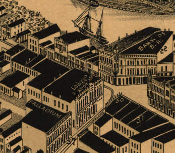
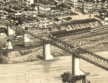
Benton Harbor MI 1889
$17.95 – $47.95 -
Benwood WV 1882
$17.95 – $47.95 -
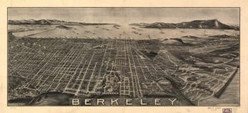
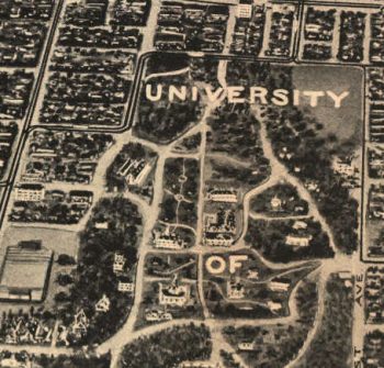
Berkeley CA in 1909
$17.95 – $47.95 -
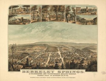
Berkeley Springs WV 1889
$17.95 – $47.95
![Battle-field of Chickamauga. [Sept 18-20, 1863]. Wells, Jacob](https://www.ushistoricalarchive.com/wp-content/uploads/nc/data/products/im/cw/ga/b24-350x256.gif)


![Beaufort Harbor and coast line between Charleston, S.C. and Savanna [sic] Ga.](https://www.ushistoricalarchive.com/wp-content/uploads/nc/data/products/im/cw/ga/b62-350x274.gif)