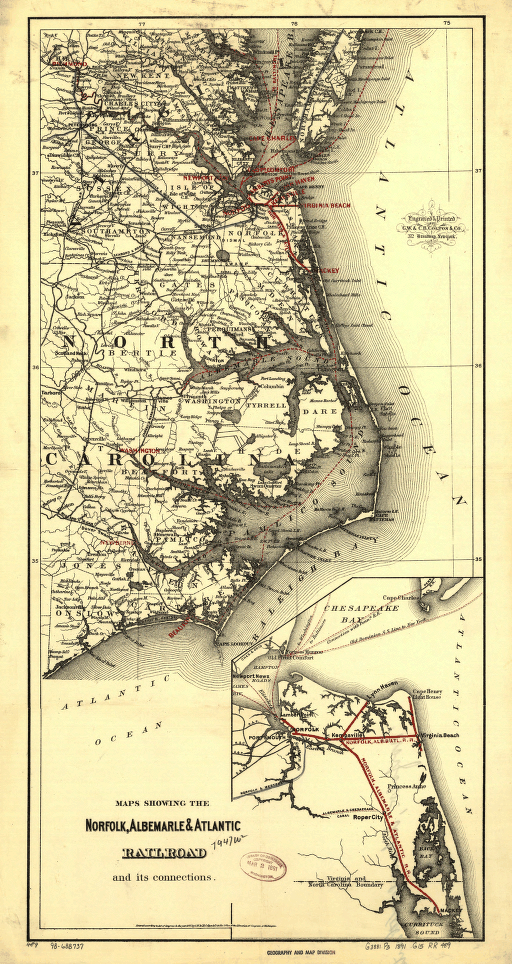
Maps showing the Norfolk, Albermarle & Atlantic Railroad and its connections. Main map shows southern tidewater Virginia and eastern North Carolina. Indicates drainage, cities and towns, counties, canals, and railroads in blue and red. G.W. & C.B. Colton & Co. CREATED/PUBLISHED New York, 1891.


