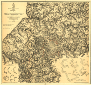
by the U.S. forces under command of Maj. Gen. W.T. Sherman, from the passage of Peach Tree Creek, July 19th 1864, to the commencement of the movement upon the enemy's lines of communication south of Atlanta, August 26, 1864 / reduced and engraved in the Engineer Bureau, War Dept., from an original prepared under the directions of Cap. O.M. Poe, Corps of Eng's and senr. engr. on Gen'l. Sherman's staff ; Edw. Molitor, lith. Poe, O. M. (Orlando Metcalfe), 1832-1895. CREATED/PUBLISHED [Washington, D.C.] : War Dept., [1865?] (Engineer Bureau, War Dept.) NOTES Partial cadastral map showing selected buildings and householders' names beyond city limits. Covers area extending from Mt. Gilead Church in west to Decatur in east and from Buckhead in north to East Point in south. Relief shown by hachures and spot heights. Shows troop positions, Union and Confederate works, roads, railroads, vegetation, drainage, and names, dates, and sites of battles connected with Atlanta Campaign.
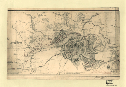
Map illustrating the siege of Atlanta, Ga.
$17.95 – $47.95
SKU: smga68
Related products
-

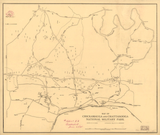
Map of Chickamauga and Chattanooga National Military Park
$17.95 – $47.95 -
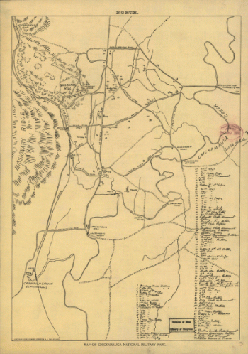
Map of Chickamauga National Military Park.
$17.95 – $47.95