A map, of the principal canal and rail road improvments [sic], which will connect with the Balt. & Susqa. Rail Road at York. Outline map covering New York, Pennsylvania, New Jersey, Delaware, Maryland, Virginia, and Ohio; shows drainage, canals, important cities, and railroad connections, chartered in 1828, opened to York in 1838. Drawn by G. F. de la Roche. C. Engr. CREATED/PUBLISHED Balt[im]o[re], 1835. Scale ca. 1:2,000,000.

Baltimore and Susquehanna Railroad Company
$17.95 – $47.95
SKU: rrac27
Related products
-

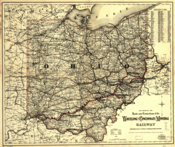
Wheeling and Cincinnati Mineral Railway
$17.95 – $47.95 -
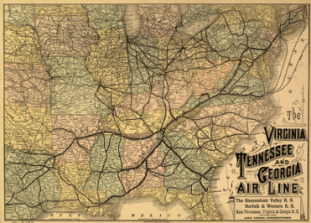
Virginia, Tennessee, and Georgia Air Line Railroad
$17.95 – $47.95 -
Winchester and Potomac Railroad Company
$17.95 – $47.95 -
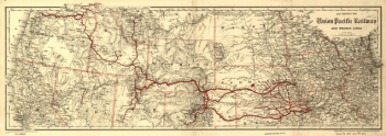
Union Pacific Railway Company
$17.95 – $47.95