Home
All Products
Historic Maps
American Indian Maps
Birds Eye View Maps
Civil War Maps
Panoramic Maps
Railroad Maps
Revolutionary War Maps
State Maps
Historic Prints
Civil War Prints
Civil War Posters
Historic Portraits
Presidential Portraits
Contact Us
0
0
press
Enter
to search
Showing all results:
No products found.
Home
/
State Maps
/
New York
/
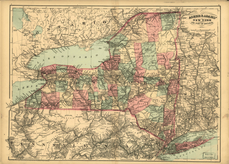
Asher & Adams' New York and part of Ontario.
$
17.95
–
$
47.95
SKU: smny25
Paper Size
Choose an option
12" x 18"
18" x 24"
24" x 36"
Clear
Quantity
Qty
Add to cart
Description
CREATED/PUBLISHED [S.l.], 1871.
SKU:
smny25
Category:
New York
Related products
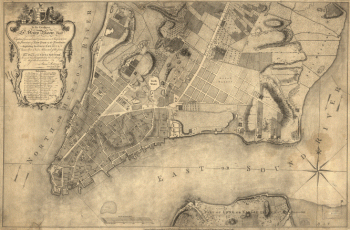
This plan of the city of New York
$
17.95
–
$
47.95
Topographic map of West Point, Constitution Island, and vicinity, N.Y.] / T.B.J. Weld.
$
17.95
–
$
47.95
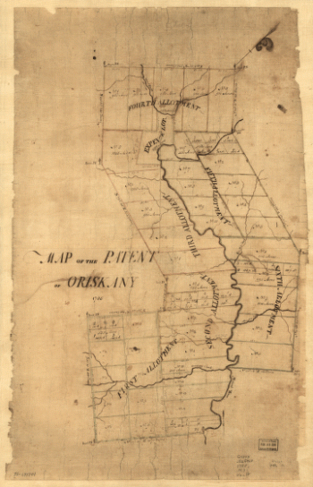
Map of the patent of Oriskany.
$
17.95
–
$
47.95
Corning, N.Y., 1882 : junction of the New York, Lake Erie, and Western and the Syracuse, Geneva & Corning R.R.'s / C.J. Corbin, field manager.
$
17.95
–
$
47.95
Search Product or SKU
×
Home
All Products
Historic Maps
American Indian Maps
Birds Eye View Maps
Civil War Maps
Panoramic Maps
Railroad Maps
Revolutionary War Maps
State Maps
Historic Prints
Civil War Prints
Civil War Posters
Historic Portraits
Presidential Portraits
Contact Us
Cart
0
Cart
Close
Updating…
No products in the cart.
Continue shopping