-

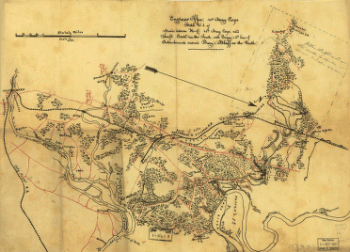
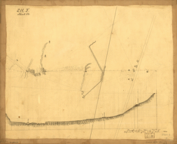
Sketch no. 4 of roads between H.-Q. 10th Army Corps and Swift Creek
Price range: $39.95 through $69.95 -
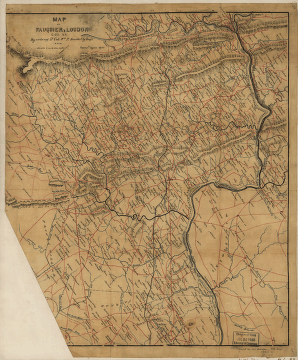
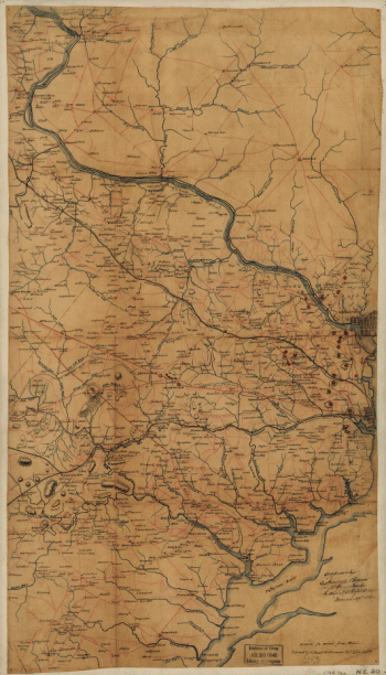
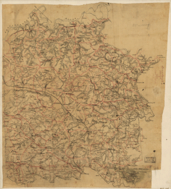
Fairfax County, and parts of Loudoun and Prince William Counties
Price range: $39.95 through $69.95 -
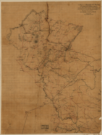
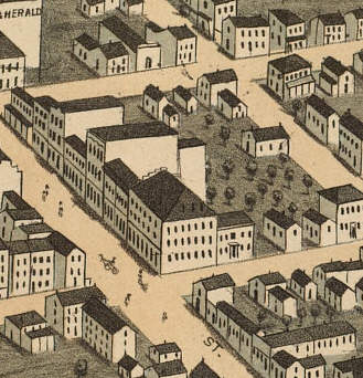
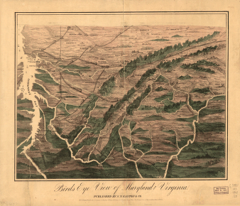
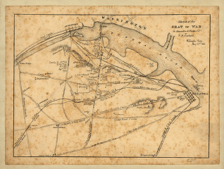
Birds eye view of Maryland and Virginia
Price range: $39.95 through $69.95 -
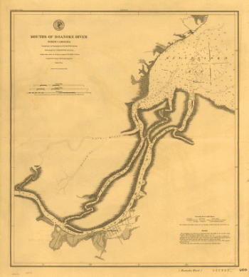
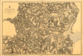
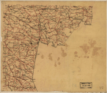
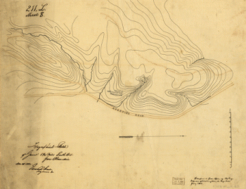
Mouths of Roanoke River, North Carolina
Price range: $39.95 through $69.95 -
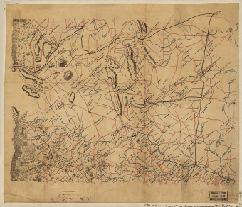
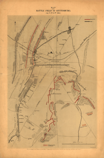
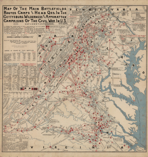
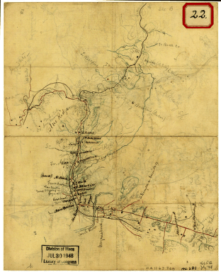
The main battlefields, routes, camps and head quarters
Price range: $39.95 through $69.95 -
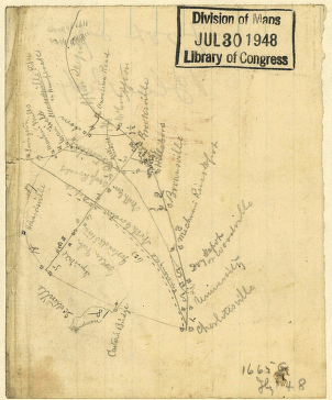
Sketch of parts of Albemarle and Nelson counties, Virginia
Price range: $39.95 through $69.95 -
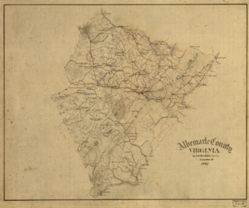
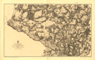
Albemarle County, Virginia
Price range: $39.95 through $69.95 -
Two blockhouses between “Turn Pike Road” and “bridge,” Alexandria, Virginia
Price range: $39.95 through $69.95 -
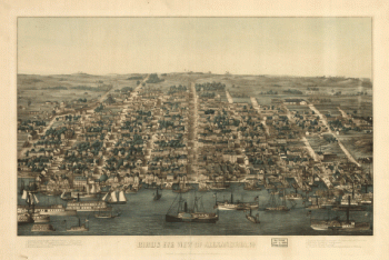
Birds eye view of Alexandria, Va.
Price range: $39.95 through $69.95 -
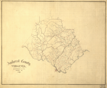
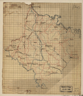
Amherst County, Virginia
Price range: $39.95 through $69.95 -
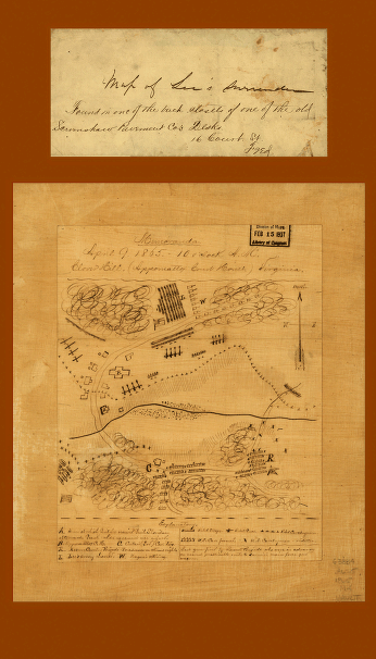
Clover Hill (Appomattox Court House) Virginia
Price range: $39.95 through $69.95 -
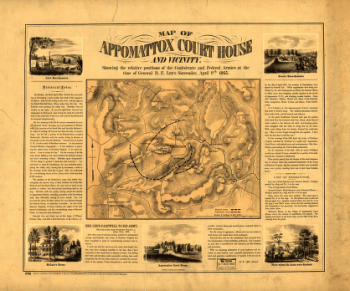
Map of Appomattox Court House and vicinity
Price range: $39.95 through $69.95 -
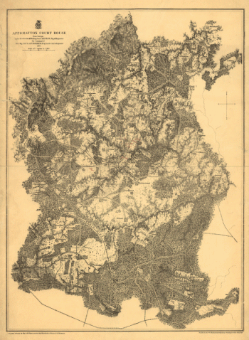
Appomattox Court House
Price range: $39.95 through $69.95 -
Sketch of the seat of war in Alexandria & Fairfax Counties
Price range: $39.95 through $69.95 -
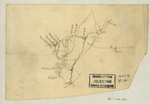
Reconnaissance in advance of Camp Mansfield
Price range: $39.95 through $69.95 -
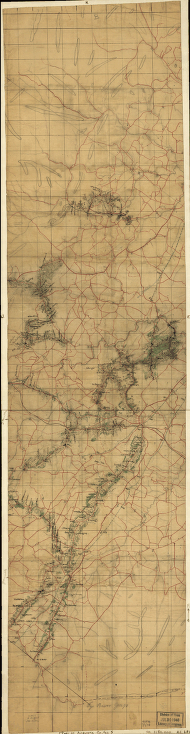
Sketch of the road from Waynesboro toward Staunton – Map 1
Price range: $39.95 through $69.95 -
Sketch of the road from Waynesboro toward Staunton – Map 2
Price range: $39.95 through $69.95 -
Augusta County, Va
Price range: $39.95 through $69.95 -
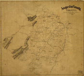
Augusta County, Virginia
Price range: $39.95 through $69.95 -
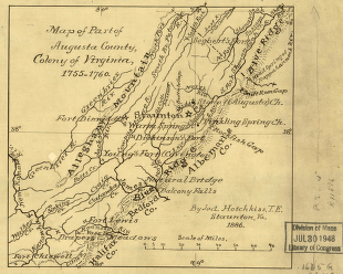
Map of Augusta Co., Virginia, 1738-1770
Price range: $39.95 through $69.95 -
Part of Augusta County, Colony of Virginia
Price range: $39.95 through $69.95 -
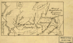
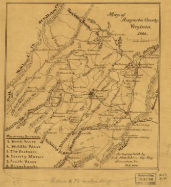
Map of Augusta County, Virginia in 1886
Price range: $39.95 through $69.95 -
muda Hundred
Price range: $39.95 through $69.95 -
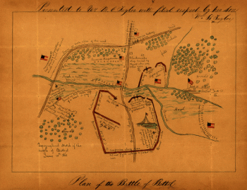
Topographical sketch of the Battle of Bethel
Price range: $39.95 through $69.95 -
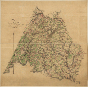
Campbell County
Price range: $39.95 through $69.95 -
Caroline County, Virginia
Price range: $39.95 through $69.95 -
Caroline County, Va.
Price range: $39.95 through $69.95 -
Parts of Caroline, Hanover, and Henrico counties
Price range: $39.95 through $69.95 -
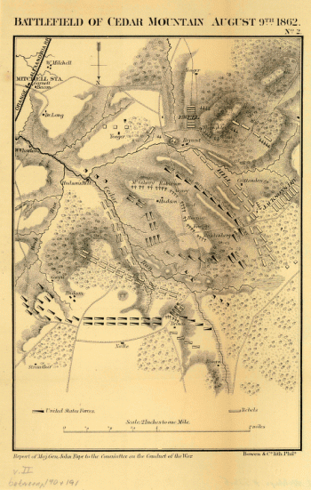
Battlefield of Cedar Mountain, August 9th, 1862
Price range: $39.95 through $69.95 -
Battle of Chancellorsville
Price range: $39.95 through $69.95 -
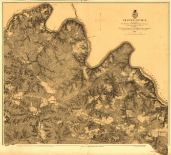
Battlefield of Chancellorsville, Va. 1863
Price range: $39.95 through $69.95 -
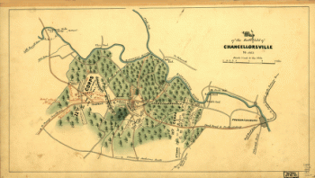
Chancellorville – May 1-3, 1863
Price range: $39.95 through $69.95 -
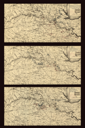
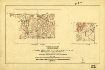
Topographic maps of Chancellorsville and Salem Church battlefields
Price range: $39.95 through $69.95 -
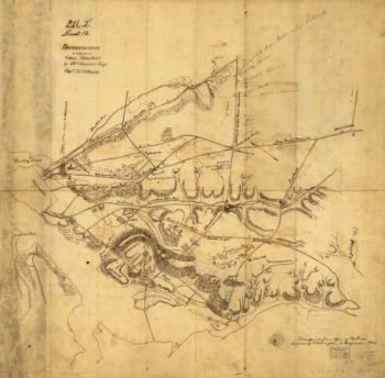
Cold Harbor – June 1-3, 1864
Price range: $39.95 through $69.95 -
Cold Harbor. [June 1-3, 1864]
Price range: $39.95 through $69.95 -
Cold Harbor. [June 1-3, 1864]
Price range: $39.95 through $69.95 -
Sketch of the vicinity of Cross Keys, Va.
Price range: $39.95 through $69.95 -
Culpeper County
Price range: $39.95 through $69.95 -
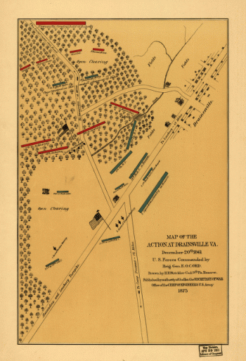
The action at Drainsville, Va., December 20th 1861
Price range: $39.95 through $69.95 -
Topographical sketch of ground 1 1/2 miles south west from Alexandria
Price range: $39.95 through $69.95 -
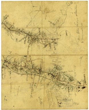
High Bridge and Farmville. [1865]
Price range: $39.95 through $69.95 -
Fauquier County, Virginia
Price range: $39.95 through $69.95 -
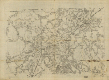
Parts of Fauquier, Prince William, and Rappahannock counties
Price range: $39.95 through $69.95 -
Fauquier & Loudon counties
Price range: $39.95 through $69.95 -
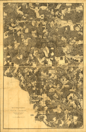
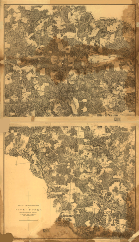
The battlefield of Five-Forks
Price range: $39.95 through $69.95 -
Map of the battlefield of Five-Forks
Price range: $39.95 through $69.95

![Cold Harbor. [June 1-3, 1864]](https://www.ushistoricalarchive.com/wp-content/uploads/nc/data/products/im/cw/va1/b43-350x232.gif)
![Cold Harbor. [June 1-3, 1864]](https://www.ushistoricalarchive.com/wp-content/uploads/nc/data/products/im/cw/va1/b44-350x469.gif)
![High Bridge and Farmville. [1865]](https://www.ushistoricalarchive.com/wp-content/uploads/nc/data/products/im/cw/va1/b57.gif)