-

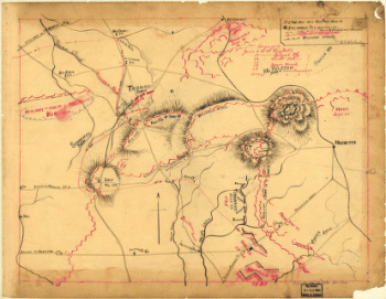
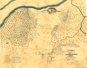
Map of the environs of Pine Mountain, Lost Mountain, Kenesaw Mountain, and Little Kenesaw Mountain
Price range: $39.95 through $69.95 -
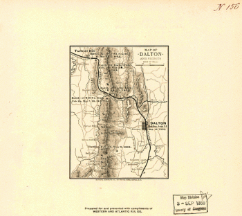
Map of Dalton and vicinity
Price range: $39.95 through $69.95 -
Ft. McAllister
Price range: $39.95 through $69.95 -
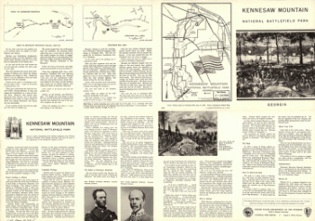
Kennesaw Mountain National Battlefield Park, Georgia
Price range: $39.95 through $69.95 -
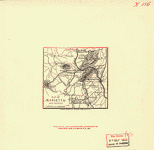
Map of Marietta and vicinity
Price range: $39.95 through $69.95 -
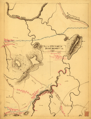
om the Etowah to Burnt-Hickory, Ga
Price range: $39.95 through $69.95 -
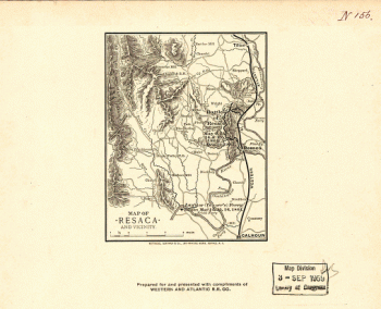
Map of Resaca and vicinity
Price range: $39.95 through $69.95 -
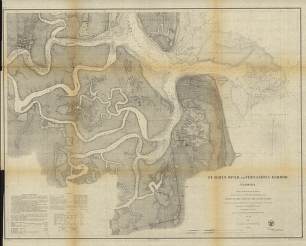
St. Mary's River and Fernandina harbor, Florida
Price range: $39.95 through $69.95 -
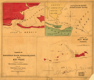
Charts of Savannah River, Pensacola Bay, and Key West
Price range: $39.95 through $69.95 -
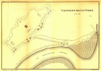
“Causten's Bluff” fort
Price range: $39.95 through $69.95 -
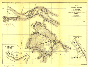
Map showing the defences of Savannah, on the approaches of Wilmington and Savannah Rivers, Georgia
Price range: $39.95 through $69.95 -
Map illustrating the defence of Savannah, Ga
Price range: $39.95 through $69.95 -
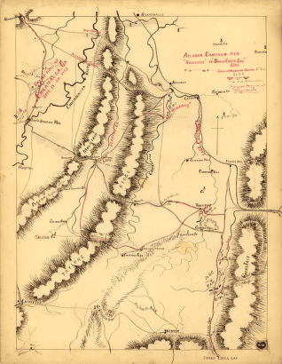
Atlanta campaign-1864. “Rossville” to “Snake Creek Gap.”
Price range: $39.95 through $69.95 -
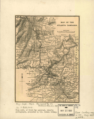
Map of the Atlanta campaign
Price range: $39.95 through $69.95 -
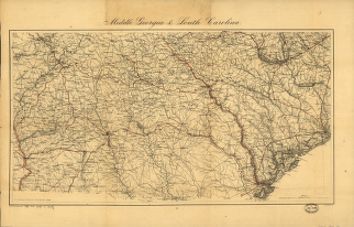
Middle Georgia & South Carolina / U.S. Coast Survey
Price range: $39.95 through $69.95 -
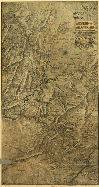
Birds-eye map of the Western and Atlantic R.R
Price range: $39.95 through $69.95 -
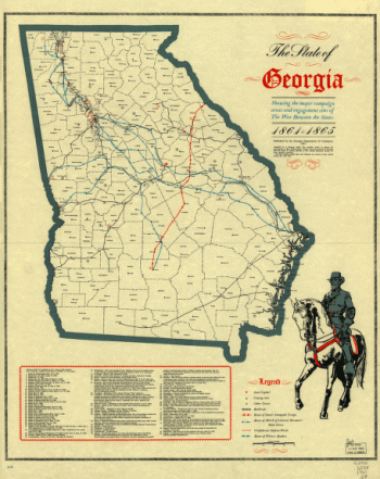
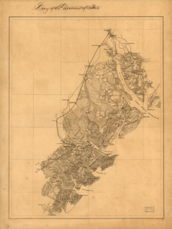
The State of Georgia
Price range: $39.95 through $69.95 -
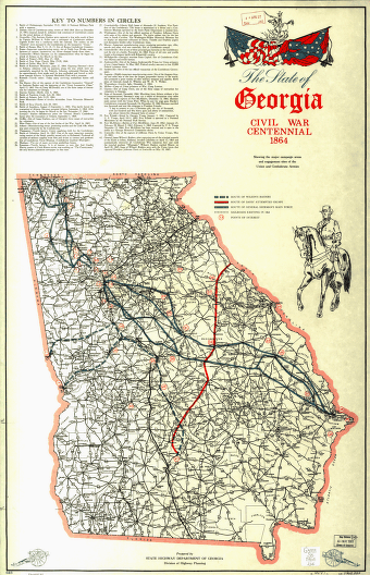
The State of Georgia, Civil War Centennial, 1864
Price range: $39.95 through $69.95 -
Map illustrating the first epoch of the Atlanta Campaign
Price range: $39.95 through $69.95 -
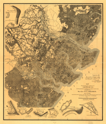
Map of the environs of Savannah, Georgia
Price range: $39.95 through $69.95 -
Map of the seat of war, in South Carolina, and Georgia
Price range: $39.95 through $69.95 -
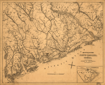
Beaufort Harbor and coast line between Charleston, S.C. and Savanna [sic] Ga.
Price range: $39.95 through $69.95 -
Sketch of sea coast of South Carolina and Georgia
Price range: $39.95 through $69.95 -
Sketch showing position of Boyd's Neck, Honey Hill, and Devaux' Neck
Price range: $39.95 through $69.95 -
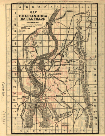
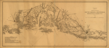
Battle map of Chickamauga, Georgia. Saturday 19 [and] Sunday, 20 September 1863
Price range: $39.95 through $69.95 -
Battle map of Chickamauga, Georgia.
Price range: $39.95 through $69.95 -
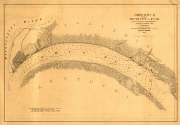
Ohio River between Mound City and Cairo
Price range: $39.95 through $69.95 -
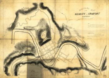
Military map of the vicinity of Frankfort, Kentucky
Price range: $39.95 through $69.95 -
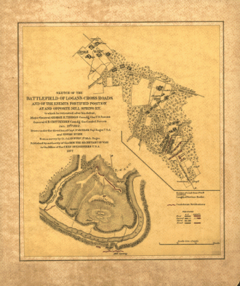
Sketch of the battlefield of Logan's Cross Roads
Price range: $39.95 through $69.95 -
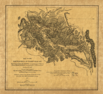
Map of the battlefield of Perryville, Ky
Price range: $39.95 through $69.95 -
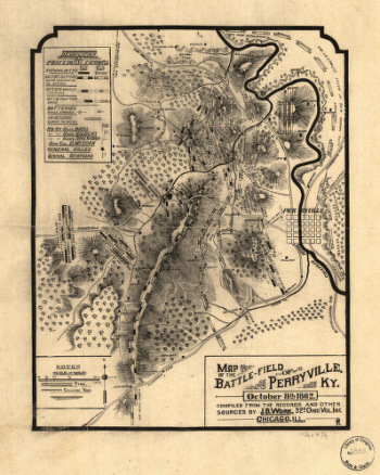
Map of the battle-field of Perryville, Ky
Price range: $39.95 through $69.95 -
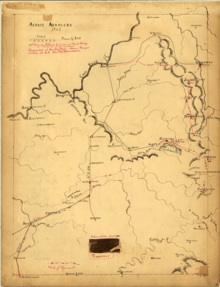
Across Kentucky Drawn by G.H.B
Price range: $39.95 through $69.95 -
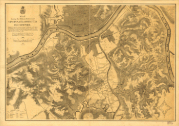
Map showing the military defences of Cincinnati, Covington and Newport
Price range: $39.95 through $69.95 -
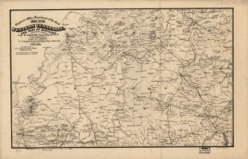
Western Tennessee, and part of Kentucky
Price range: $39.95 through $69.95 -
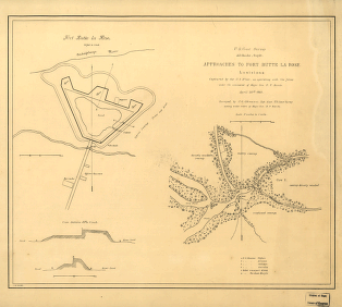
Approaches to Fort Butte La Rose, Louisiana
Price range: $39.95 through $69.95 -
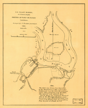
Sketch of Fort De Russy, Louisiana Surveyed by C. Fendall, Sub Assist
Price range: $39.95 through $69.95 -
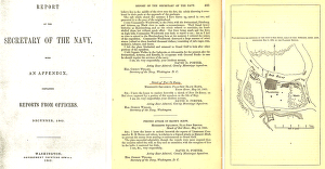
Plan showing the defences of the fort on Red River
Price range: $39.95 through $69.95 -
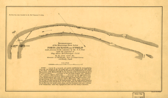
Reconnoissance of the Mississippi River below Forts Jackson and St. Philip
Price range: $39.95 through $69.95 -
Reconnoissance of the Mississippi River below Forts Jackson and St. Philip
Price range: $39.95 through $69.95 -
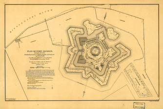
Plan of Fort Jackson
Price range: $39.95 through $69.95 -
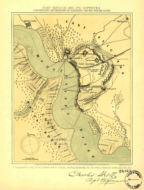
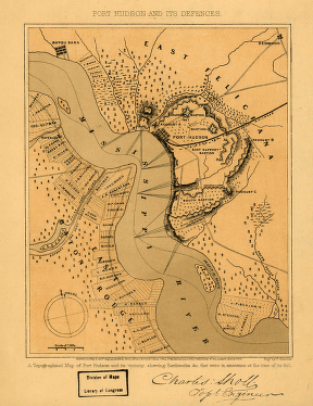
Port Hudson and its defences
Price range: $39.95 through $69.95 -
Port Hudson and its defences
Price range: $39.95 through $69.95 -
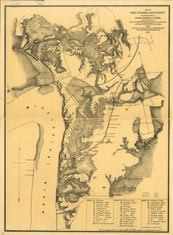
Map of Port Hudson and vicinity
Price range: $39.95 through $69.95 -
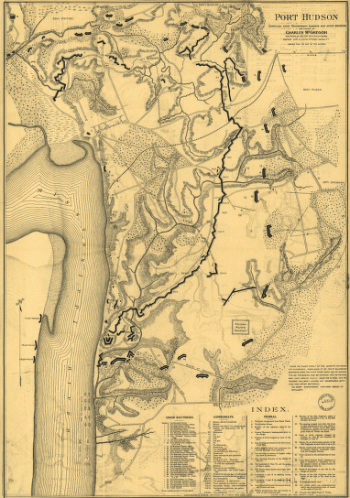
Port Hudson
Price range: $39.95 through $69.95 -
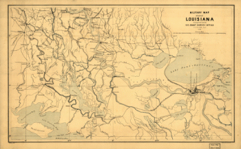
Military map of part of Louisiana
Price range: $39.95 through $69.95 -
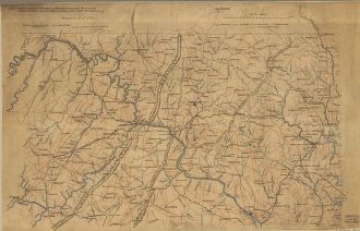
Part of map of portions of the milit'y dept's of Washington, Pennsylvania, Annapolis, and north eastern Virginia
Price range: $39.95 through $69.95 -
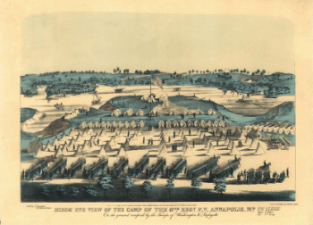
Birds' eye view of the camp of the 67th Reg't P.V. Annapolis, Md.
Price range: $39.95 through $69.95 -
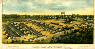
Parole Camp, Annapolis
Price range: $39.95 through $69.95

![Beaufort Harbor and coast line between Charleston, S.C. and Savanna [sic] Ga.](https://www.ushistoricalarchive.com/wp-content/uploads/nc/data/products/im/cw/ga/b62-350x274.gif)

![Battle map of Chickamauga, Georgia. Saturday 19 [and] Sunday, 20 September 1863](https://www.ushistoricalarchive.com/wp-content/uploads/nc/data/products/im/cw/ga/b69a.gif)