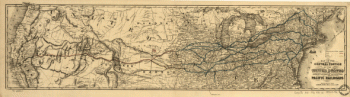
Map of the Toledo, Wabash, and Gt. Western Rail Road Line, and its connections. utline map of the northeastern and north-central United States showing railroad lines and major cities. At left of map: “The Shortest and only Direct line!-to-St. Louis, Hannibal, Quincy, St. Joseph, Fort Leavenworth, Kansas City, Jefferson City, Council Bluffs, Omaha City, Cherry Creek, Pike's Peak, and the Gold Regions of Kansas and Nebraska.” Olmstead, S. R. (Samuel R.) CREATED/PUBLISHED [n.p., 1859] Scale ca. 1:8,000,000.
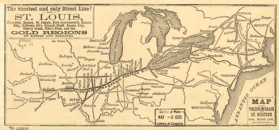
Toledo, Wabash, and Great Western Railroad
$17.95 – $47.95
SKU: rrsz41
Related products
-

Union Pacific Railroad Company
$17.95 – $47.95 -
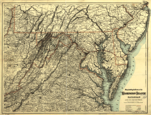
Washington and Atlantic Railroad
$17.95 – $47.95 -
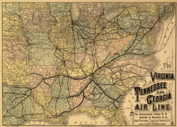
Virginia, Tennessee, and Georgia Air Line Railroad
$17.95 – $47.95 -
Union Pacific Railroad Company
$17.95 – $47.95