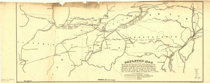
Showing the position and connections of the Michigan Southern Rail Road (from Toledo to Chicago) with the several great rail road routes to the Atlantic seaboard and New York City via the south shore of Lake Erie. Jervis, John B. (John Bloomfield), 1795-1885. CREATED/PUBLISHED N[ew] Y[ork], 1850. NOTES Scale ca. 1:3,000,000. SUMMARY Outline map of the northeastern United States showing railroads in operation, under construction, and under proposal. Chartered in 1846 and consolidated April 1855 with the Northern Indiana Railroad under the name Michigan Southern and Northern Indiana Railroad.
Skeleton map
Price range: $39.95 through $69.95
SKU: smmi4
Related products
-

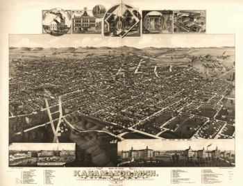
Bird's eye view of Kalamazoo, Mich. 1883. Drawn by H. Wellge & A. F. Poole. Beck & Pauli, lithographers.
Price range: $39.95 through $69.95 -
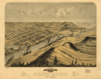
Birds eye view of the city of Grand Haven, Ottawa Co., Michigan 1868
Price range: $39.95 through $69.95 -
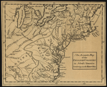
An accurate map of the English colonies in North America, bordering on the river Ohio.
Price range: $39.95 through $69.95 -
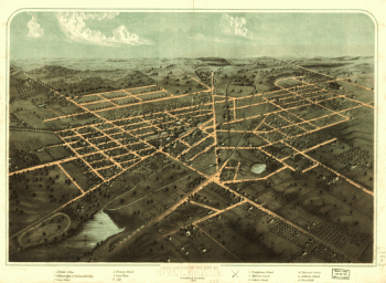
Birds eye view of the city of Hillsdale, Hillsdale Co., Mich. 1866. Drawn & published by A. Ruger.
Price range: $39.95 through $69.95