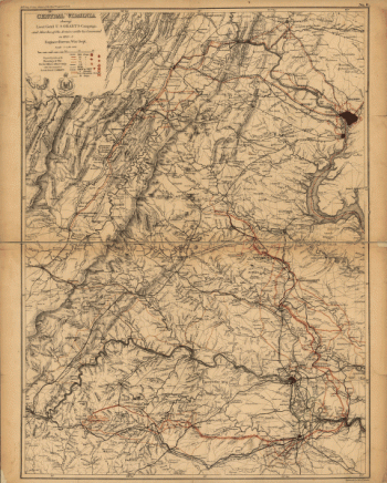
Schonberg & Co. . CREATED/PUBLISHED New York, 1864 NOTES Scale ca. 1:425,000. Map extends from Ashby's Gap south to Winfield and Charlottesville east to Tappahannock and shows the location and date of engagements, towns, roads, railroads, county names and
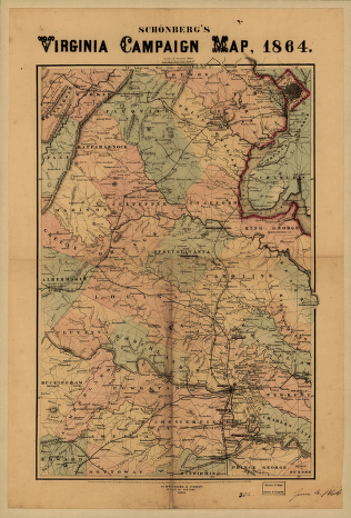
Schonberg's Virginia campaign map, 1864
$17.95 – $47.95
SKU: cw3va0069
Related products
-

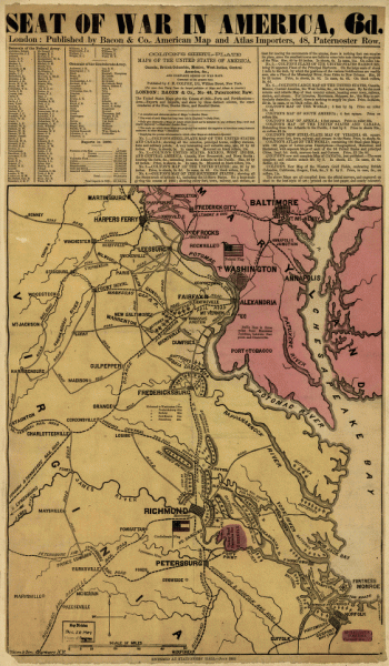
Seat of war in America, 6d
$17.95 – $47.95 -
Central Virginia
$17.95 – $47.95 -
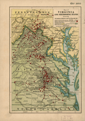
Virginia and neighboring states
$17.95 – $47.95 -
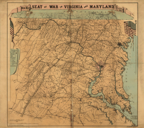
New map of the seat of war in Virginia and Maryland
$17.95 – $47.95