Map of the Reading & Columbia Rail Road connecting New York via the Jersey Central, Reading and Columbia, with Baltimore and Washington, together with Western R.R. connections to Wheeling and Pittsburg [sic]; compiled by S. P. Kase. ketch map of eastern Pennsylvania and northern Maryland indicating the railroad network and the connections with the coal fields. Shows major drainage, cities and towns, and four main coal field areas. Kase, S. P. CREATED/PUBLISHED N[ew] Y[ork], [185-] Scale ca. 1:600,000.
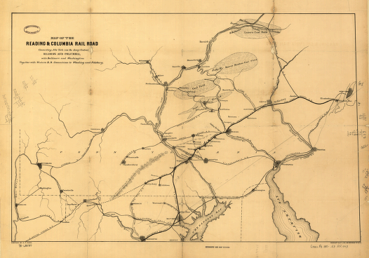
Reading and Columbia Railroad
$17.95 – $47.95
SKU: rrpr62
Related products
-

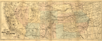
Union Pacific Railroad Company
$17.95 – $47.95 -
Winchester and Potomac Railroad Company
$17.95 – $47.95 -
Western and Atlantic Railroad Company
$17.95 – $47.95 -
Western and Atlantic Railroad Company
$17.95 – $47.95