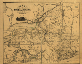
Map showing the location of the N.Y. & Oswego Midland R.R. with existing and proposed connection, January 1st 1869, [by Van R. Richmond, State Engr. & Surv.] Map of New York State and vicinity showing drainage, canals, cities and towns, and named railroads. January 1st, 1870 edition has “W. B. Gilbert, Chief Engineer.” Richmond, Van R. CREATED/PUBLISHED New York, 1869. Scale ca. 1:1,000,000.


