Map showing the New Orleans, Mobile & Chattanooga Railroad and its connections. Map of the eastern half of the United States showing drainage, cities and towns, counties, and the railroad network. G.W. & C.B. Colton & Co. CREATED/PUBLISHED New York, 1865. Scale 1:3,168,000.
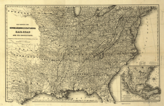
New Orleans, Mobile, and Chattanooga Railroad
$17.95 – $47.95
SKU: rrlo41
Related products
-

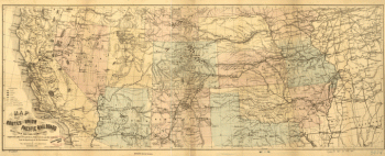
Union Pacific Railroad Company
$17.95 – $47.95 -
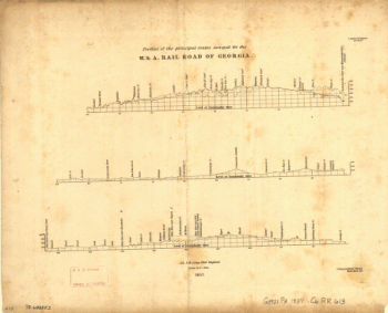
Western and Atlantic Railroad Company
$17.95 – $47.95 -
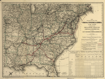
Virginia, Tennessee, and Georgia Air Line Railroad
$17.95 – $47.95 -
Winchester and Potomac Railroad Company
$17.95 – $47.95