(The most central, attractive, direct and reliable thoroughfare between the eastern and western states) Noble, C. E., fl. 1856. CREATED/PUBLISHED Buffalo, N.Y., c1856. NOTES Scale ca. 1:3,250,000. Entered according to act of Congress, in the year 1856. At right of map: 'Statistics of suspension bridge.' Inset: [View of] Mammoth suspension bridge over Niagara River in view of the falls. SUMMARY Outline map of the north-central and northeastern states indicating larger cities, county boundaries, and railroad network emphasizing the Michigan Central Railroad and the Great Western Railway.
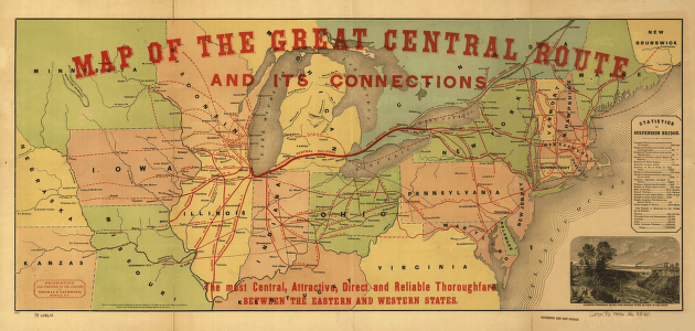
Map of the Great Central Route and its connections
$17.95 – $47.95
SKU: smmi63