G.W. & C.B. Colton & Co. CREATED/PUBLISHED New York, 1885. NOTES Scale 1:58,000. Map of the five borough area of New York showing drainage, settlements, streets, roads, and railroads. 'Manhattan (El.) R'y,' 'Long Island R.R.,' 'proposed Cable El. R'y,' and connections are color coded.
![Map of New York City, Brooklyn, and vicinity, shewing [sic] suburban lines of Long Island Railroad and its connections.](https://www.ushistoricalarchive.com/wp-content/uploads/nc/data/products/im/sm/nyc/b8.gif)
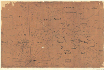
Map of New York City, Brooklyn, and vicinity, shewing [sic] suburban lines of Long Island Railroad and its connections.
$17.95 – $47.95
SKU: smnyc8
Related products
-

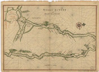
Noort Rivier in Niew Neerlandt.
$17.95 – $47.95 -
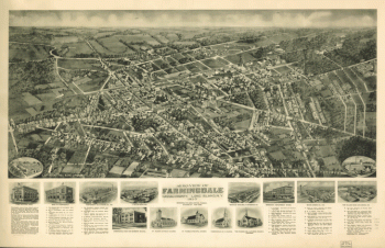
Aero-view of Farmingdale, Nassau County, Long Island, N.Y. 1925.
$17.95 – $47.95 -
Environs de New-York, de Long-Island, etc.
$17.95 – $47.95 -
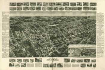
Aero-view of Amityville, Suffolk County, Long Island, N.Y. 1925.
$17.95 – $47.95