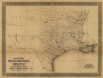
G.W. & C.B. Colton & Co. CREATED/PUBLISHED New York, 1881. NOTES Scale 1:2,090,880. Detailed map of the central portion of the United States showing drainage, cities and towns, and the iron and timber areas in Texas. Indicates the railroad network with emphasis on the main lines.
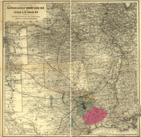
Kansas & Gulf Short Line R.R. and the Texas & St. Louis R'y with its branches, extensions and connections
$17.95 – $47.95
SKU: smtx51
Related products
-

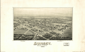
Sunset, Montague Co., Texas, 1890
$17.95 – $47.95 -
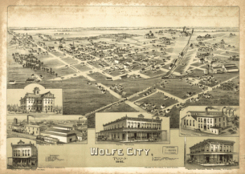
Wolfe City, Texas 1891.
$17.95 – $47.95 -
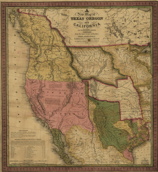
A new map of Texas, Oregon and California.
$17.95 – $47.95 -
Campaign map of Texas, Louisiana and Arkansas
$17.95 – $47.95