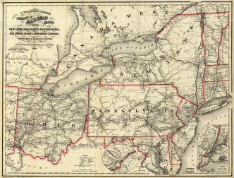
Colton, G. Woolworth (George Woolworth), 1827-1901. CREATED/PUBLISHED New York, 1854. NOTES Scale ca. 1:750,000. At right of map is a population 'Census of the State of Ohio' by cities for 1840 and 1850. SUMMARY Detailed map showing drainage, railroads under construction and completed, canals, post roads, towns, townships, villages, post offices, and county boundaries.
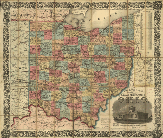
Colton's railroad & township map of the state of Ohio, drawn by George W. Colton, engraved by J M. Atwood.
$17.95 – $47.95
SKU: smoh21
Related products
-

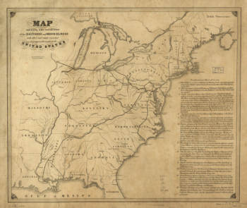
Connection of the Baltimore and Ohio rail road
$17.95 – $47.95