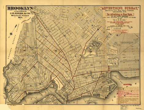
J.B. Beers & Co. CREATED/PUBLISHED New York, 1874. NOTES Scale ca. 1:20,000. Street map of Brooklyn published for Advertising Bureau, Brooklyn City Rail Road Company. Overprinted in brown to show 'Twelve Routes, 42 miles of Streets and Avenues Traversed by Cars, all Starting from Fulton Ferry.' Contains a list of routes in lower left of map.


