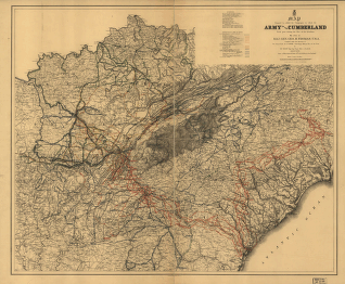
[1861-65] By order of Maj. Gen. Geo. H. Thomas, U.S.A. Compiled under the direction of Bvt. Major Genl. Z. B. Tower, Chief Eng'r., Military Div. of the Tenn., by Ed. Ruger, Sup't Top'l. Eng'r. Office at Nashville. Assistants: Capt. A. Kilp & Lieut. R. Flach, 3rd U.S.C.A. (Heavy) & Asst. Top Engrs. Julius Bien & Co., photo lith., N.Y. Ruger, Edward. CREATED/PUBLISHED [N.Y., 1865] NOTES Scale 1:1,267,200. Map of South Carolina, Kentucky, and Tennessee, and parts of Georgia, Alabama, Mississippi, North Carolina, and Virginia, showing roads, railroads, towns, rivers, names and boundaries of states, and relief by hachures. Lines of march are indicated by colors and symbols. Includes 'Jeff. Davis' line of flight.'


