Reid, John, publisher. CREATED/PUBLISHED [S.l., 1795]
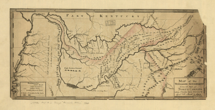
A map of the Tennessee government, formerly part of North Carolina
$17.95 – $47.95
SKU: smtn7
Related products
-

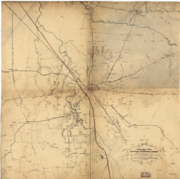
Topographical sketch of the environs of Murfreesboro, Tennessee
$17.95 – $47.95 -
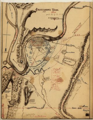
Chattanooga Tenn. 1863 / G.H. Blakeslee, U.S. Top. Eng.
$17.95 – $47.95 -
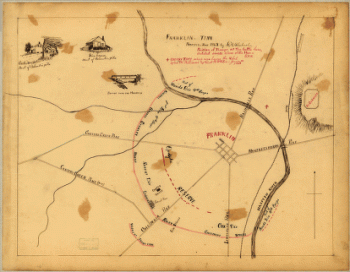
Franklin, Tennessee
$17.95 – $47.95
![Map of Chattanooga and environs. Engraved by Buff[alo] Elec. & Eng. Co.](https://www.ushistoricalarchive.com/wp-content/uploads/nc/data/products/im/sm/tn/b81.gif)