Showing the contemplated route of the New Orleans & Ohio Railroad and the Central Railroad of Illinois, also the route of the Mobile & Ohio Railroad representing the most central, direct and practicable route for a great national and commercial highway between the Gulf of Mexico and the Great Northern Lakes, and by various branches and intersections with other Railways connecting with all the principal cities of the United States. McBean, William. CREATED/PUBLISHED New Orleans, 1850. NOTES Scale ca. 1:15,000,000. The map covers an area from Lake Michigan to the Mississippi delta, and from Columbus, Ohio, to Little Rock, Ark. It shows Ft. Massac and 'Capitol City' in southern Illinois and northern Kentucky as sites selected by the U.S. for the 'Western Armory,' and the probable future site for the seat of government of the United States or Western District of Columbia. Chartered January 9, 1852.

A map of a part of the southern & western states
$17.95 – $47.95
SKU: smoh11
Related products
-

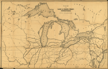
View of the lake & north west-connections with Philadelphia.
$17.95 – $47.95 -
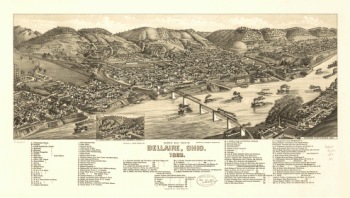
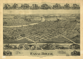
Canal Dover, Tuscarawas County, Ohio 1899. Drawn by A. E. Downs.
$17.95 – $47.95 -
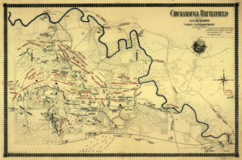
Chickamauga battlefield
$17.95 – $47.95