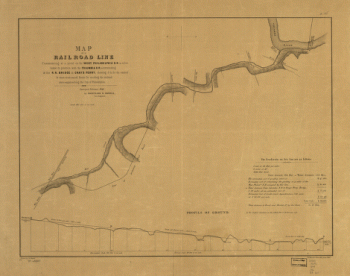
Map of a part of the State of Louisiana exhibiting the route of the New-Orleans, Opelousas & Great Western Rail Road. By G. W. R. Bayley, chief engineer. Mississippi delta area shows drainage, sugar crop, parishes, major cities and towns, canals, and railroads with lines named and distances on the main line. This railroad was opened for first 50 miles on March 6, 1854. It was purchased in 1878 by the Morgan's Louisiana and Texas Railroad. Bayley, G. W. R. CREATED/PUBLISHED N[ew] O[rleans] Eng. by Childs & Hammond [1853] Scale ca. 1:550,000.

New Orleans, Opelousas, and Great Western Railroad Company
$17.95 – $47.95
SKU: rrlo42
Related products
-

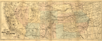
Union Pacific Railroad Company
$17.95 – $47.95 -
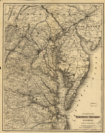
Washington City and Point Lookout Railroad
$17.95 – $47.95 -
West Philadelphia Rail Road Company
$17.95 – $47.95 -
Western and Atlantic Railroad Company
$17.95 – $47.95