Tennessee
-

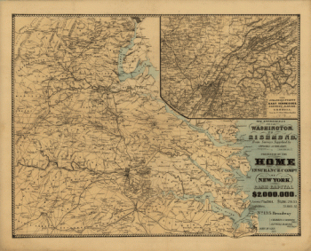
The approaches from Washington to Richmond
$17.95 – $47.95 -
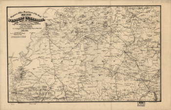
Western Tennessee, and part of Kentucky
$17.95 – $47.95 -
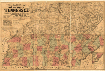
Lloyd's official map of the State of Tennessee 2
$17.95 – $47.95 -
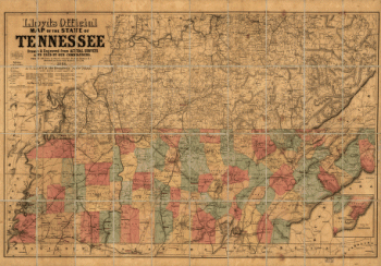
Lloyd's official map of the State of Tennessee
$17.95 – $47.95 -
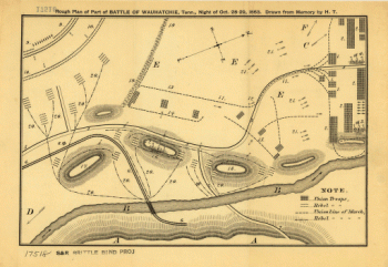
Rough plan of part of battle of Wauhatchie, Tenn.
$17.95 – $47.95 -
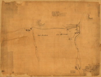
From Mitchelsville to Gallatin–Sumner Co.
$17.95 – $47.95 -
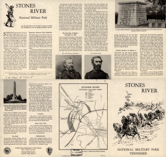
Stones River National Military Park, Tennessee
$17.95 – $47.95 -
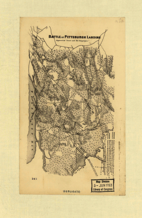
Battle of Pittsburgh Landing – Shiloh
$17.95 – $47.95 -
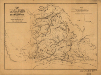
The field of Shiloh, near Pittsburgh Landing, Tenn.
$17.95 – $47.95 -
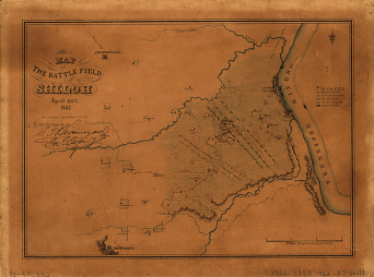
Map of the battle field of Shiloh
$17.95 – $47.95 -
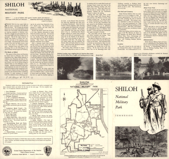
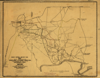
Shiloh National Military Park
$17.95 – $47.95 -
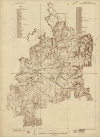
Shiloh National Military Park, Tenn.
$17.95 – $47.95 -
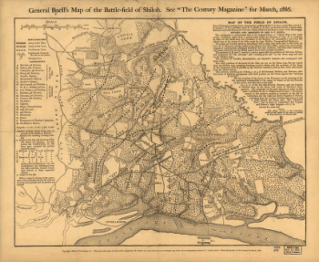
General Buell's map of the battle-field of Shiloh
$17.95 – $47.95 -
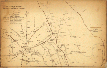
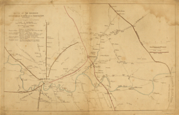
The environs of Shelbyville, Wartrace & Normandy
$17.95 – $47.95 -
The environs of Shelbyville, Wartrace & Normandy, Tennessee
$17.95 – $47.95 -
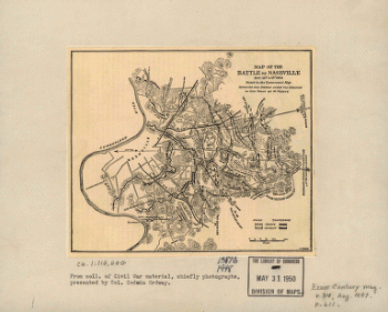
The battle of Nashville
$17.95 – $47.95 -
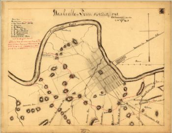
Nashville and vicinity in 1863
$17.95 – $47.95 -
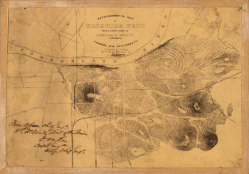
Topographical map of Nashville, Tenn.
$17.95 – $47.95 -
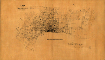
Nashville, Tennessee
$17.95 – $47.95 -
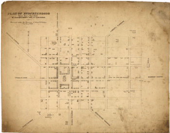
Murfreesboro
$17.95 – $47.95 -
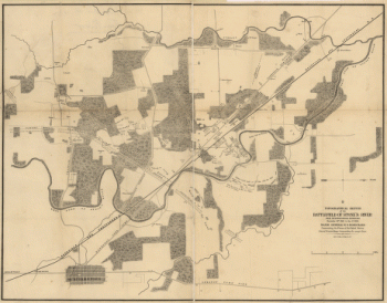
Topographical sketch of the battlefield of Stone's River
$17.95 – $47.95 -
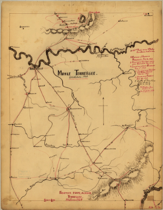
Middle Tennessee
$17.95 – $47.95 -
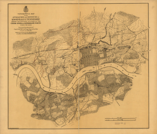
Approaches and defences of Knoxville, E. Tennessee
$17.95 – $47.95 -
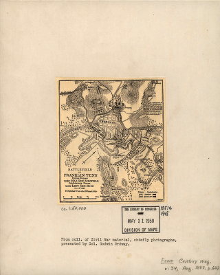
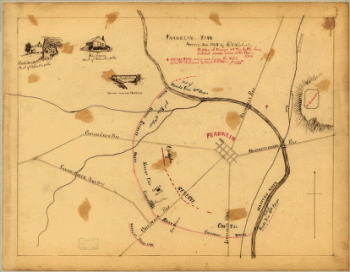
Battlefield of Franklin, Tenn.
$17.95 – $47.95 -
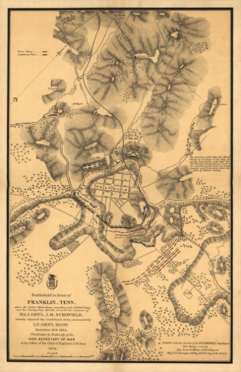
Battlefield in front of Franklin
$17.95 – $47.95 -
Battlefield in front of Franklin
$17.95 – $47.95 -
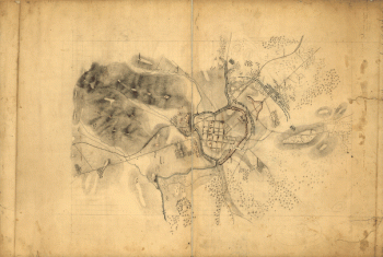
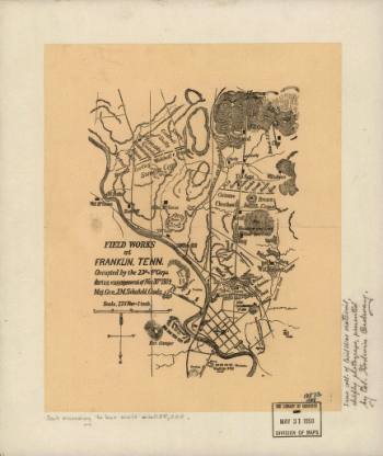
Field works at Franklin
$17.95 – $47.95 -
Franklin, Tenn
$17.95 – $47.95 -
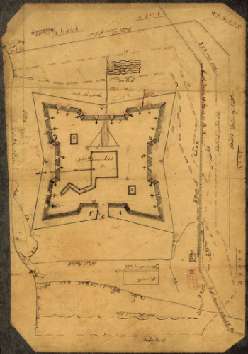
Fort Sanders, Knoxville – Map 2
$17.95 – $47.95 -
Fort Sanders, Knoxville – Map 1
$17.95 – $47.95 -
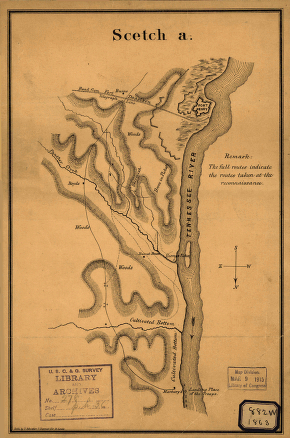
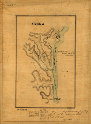
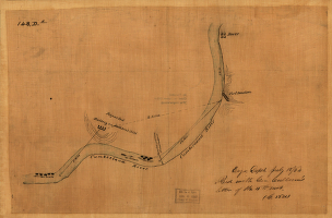
Original maps of Forts Henry & Donelson and vicinity
$17.95 – $47.95 -
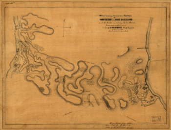
The relative positions of Fort Henry and Fort Donelson
$17.95 – $47.95 -
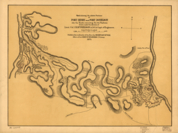
The relative positions of Fort Henry and Fort Donelson
$17.95 – $47.95 -
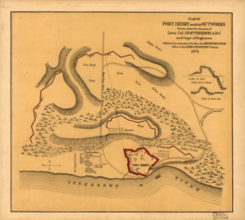
Plan of Fort Henry and its outworks
$17.95 – $47.95 -
Fort Henry, Tennessee, and environs
$17.95 – $47.95 -
Fort Henry, Tennessee, and environs
$17.95 – $47.95 -
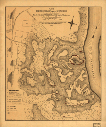
Plan of Fort Donelson and its outworks
$17.95 – $47.95 -
Map of the environs of Fort Donelson, Tennessee
$17.95 – $47.95 -
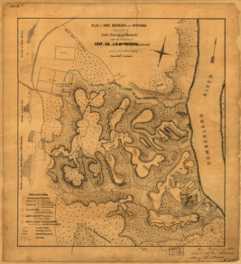
Plan of Fort Donelson and outworks
$17.95 – $47.95 -
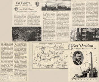
Fort Donelson National Military Park, Tennessee
$17.95 – $47.95 -
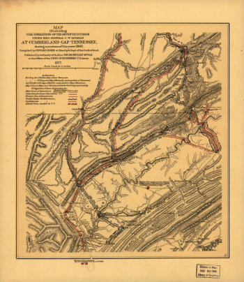
Map illustrating the operations at Cumberland Gap, Tennessee
$17.95 – $47.95 -
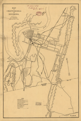
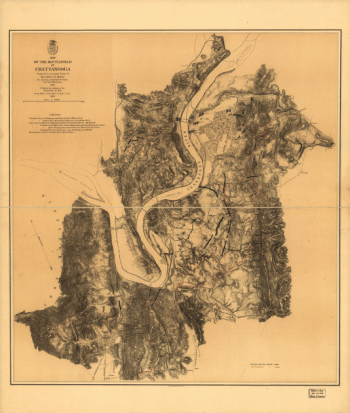
Map of Chattanooga and environs
$17.95 – $47.95 -
Battlefield of Chatanooga
$17.95 – $47.95 -
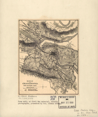
Battle of Chattanooga
$17.95 – $47.95 -
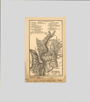
Map of the battlefield of Chattanooga
$17.95 – $47.95 -
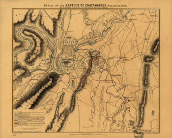
Sketch of the battles of Chattanooga
$17.95 – $47.95 -
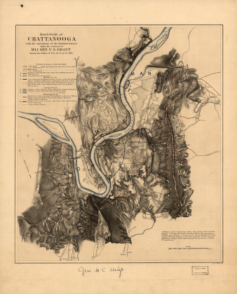
Battlefield of Chattanooga
$17.95 – $47.95