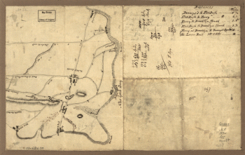
Exhibiting the plan of Fort Washington, now Fort Knyphausen, with the rebels lines to the southward, which were forced by the troops under the command of the Rt. Honble. Earl Percy, on the 16th Novr. 1776, and survey'd immediately after by order of His Lordship. To which is added the attack made to the northd. by the Hessians. Survey'd by order of Lieutt. Genl. Knyphausen. Published by permission of the Rt. Honbl. the Commissioners of Trade & Plantations. Sauthier, Claude Joseph. CREATED/PUBLISHED London, W. Faden, 1777. NOTES Scale ca. 1:20,000. Relief shown by hachures. Includes descriptive index.

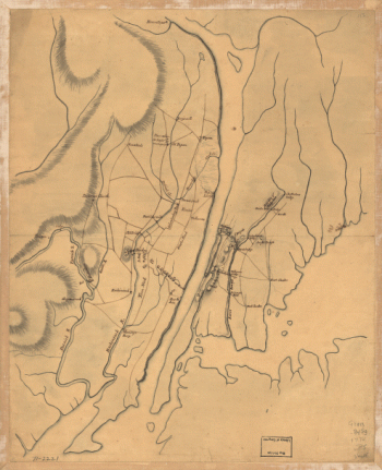
A topographical map of the northn. part of New York Island
$17.95 – $47.95
SKU: smnyc58
Related products
-

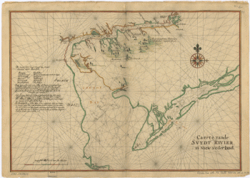
Caert vande Svydt Rivier in Niew Nederland.
$17.95 – $47.95 -
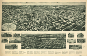
Aero-view of Valley Stream, Long Island 1924.
$17.95 – $47.95