Map of the Manassas Gap Railroad and its extensions; September, 1855. Topographical map of part of northern Virginia showing relief by hachures, drainage, cities and towns, counties, roads, and railroads with distances. Includes profiles. Chartered March 11, 1850. Opened in 1854 from Manassas Junction to Strasburg. Va. Consolidated June 1, 1867, with the Orange and Alexandria, forming the Orange, Alexandria, and Manassas Railroad. Dwyer, Thomas. CREATED/PUBLISHED Baltimore, 1855. Scale 1:253,440.

Manassas Gap Railroad Company
$17.95 – $47.95
SKU: rrlo15
Related products
-

Western and Atlantic Railroad Company
$17.95 – $47.95 -
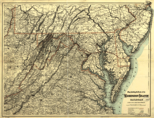
Washington and Atlantic Railroad
$17.95 – $47.95 -
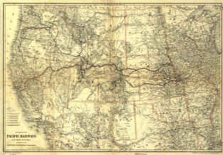
Union Pacific Railway Company
$17.95 – $47.95 -
West Philadelphia Rail Road Company
$17.95 – $47.95