Map of Peru and Indianapolis Rail Road with connections. Outline map with colored state boundaries of the northeastern and north-central United States indicating larger cities. Shows “finished,” “in progress of construction,” and “contemplated” railroads. Chartered in 1846 with first section opened in 1851. Leefe, George E. CREATED/PUBLISHED [n.p., 185-] Scale ca. 1:2,100,000.

Indianapolis and Peru Railroad Company
$17.95 – $47.95
SKU: rrdk52
Related products
-

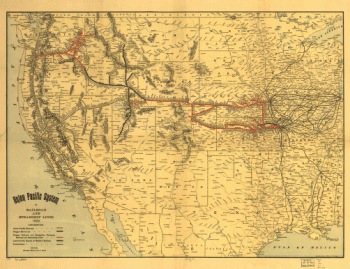
Union Pacific Railroad Company
$17.95 – $47.95 -
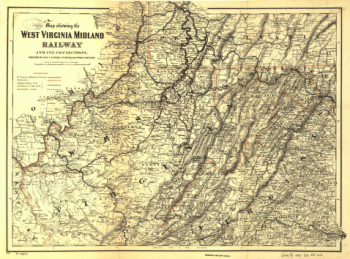
West Virginia Midland Railroad
$17.95 – $47.95 -
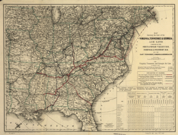
Virginia, Tennessee, and Georgia Air Line Railroad
$17.95 – $47.95 -
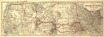
Union Pacific Railway Company
$17.95 – $47.95