Bellin, Jacques Nicolas, 1703-1772. CREATED/PUBLISHED [Paris] 1757. NOTES Covers the area from Penobscot Bay to Chesapeake Bay and west to Lake Erie. Shows provices, towns, forts, rivers, Indian tribal territory, and relief. Relief shown pictorially. Prim

Carte de la Nouvelle Angleterre, Nouvelle Yorck, et Pensilvanie. Pour servir a l'Histoire generale des voyages
$17.95 – $47.95
SKU: im0056
Related products
-

A plan of the lands in New London
$17.95 – $47.95 -
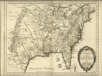
Carte de la Louisiane et des pays voisins
$17.95 – $47.95 -
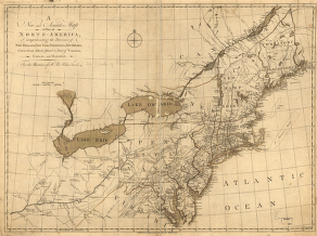
A new and accurate map of part of North-America
$17.95 – $47.95 -
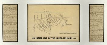
An Indian map of the Upper-Missouri
$17.95 – $47.95