Bufford, John Henry, 1810-1870. CREATED/PUBLISHED Boston, [1864] NOTES Scale ca. 1:670,000. 'The horizontal and upright lines [of the map grid] represent five miles square. By referring [sic] to the number on the left and to the letter on the base, any point may be found to show the locality of the Union armies.' SUMMARY Map covering most of Georgia and South Carolina, showing defenses along the sea coast and around the principal towns, Confederate prisons at Andersonville and south of Millen, Ga., roads, railroads, towns, drainage, and relief by hachures.

Genl. Sherman's campaign war map.
$17.95 – $47.95
SKU: smga39
Related products
-

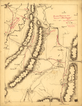
Atlanta campaign-1864. 'Rossville' to 'Snake Creek Gap.'
$17.95 – $47.95 -
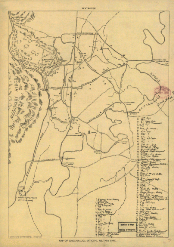
Map of Chickamauga National Military Park.
$17.95 – $47.95 -
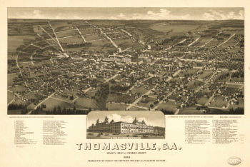
Thomasville, Ga. county-seat of Thomas-County 1885
$17.95 – $47.95