Map showing the Fredericksburg & Gordonsville Rail Road of Virginia, leading from Fredericksburg, via Orange C.H., to Charlottesville, where it connects with the Chesapeake & Ohio R.R. and the extension of the Orange & Alexandra R.R. to Lynchburg. Maps of the middle Atlantic states showing relief by hachures, drainage, cities and towns, canals, roads, and railroads, with emphasis on the main lines. Includes a list of distances for “Short Cut to Tide-Water…” Chartered March 1, 1853. Name changed in 1876 t

Fredericksburg and Gordonsville Railroad
$17.95 – $47.95
SKU: rrdk22
Related products
-

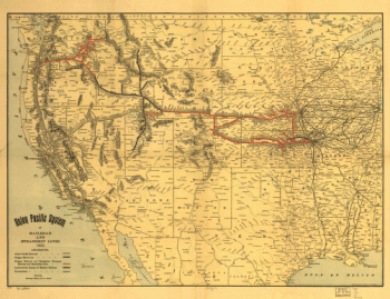
Union Pacific Railroad Company
$17.95 – $47.95 -
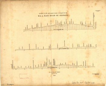
Western and Atlantic Railroad Company
$17.95 – $47.95 -
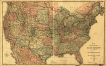
Union Pacific Railroad Company
$17.95 – $47.95 -
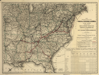
Virginia, Tennessee, and Georgia Air Line Railroad
$17.95 – $47.95