Map and profile of first 40 miles of Union Pacific Rail Road Eastern Division extending west from boundary between states of Missouri and Kansas, accompanying report of commissioners submitted to Hon. James Harlan, Secretary of the Interior, October 26th, 1865; compiled from map, submitted by U.P.R.R. Co. E.D., and records in Gen. Land Office. Detailed map showing relief by hachures, drainage, vegetation, roads, and railroads in Kansas, from Kansas City to Lawrence. Gillis, J. R. CREATED/PUBLISHED [Washington, D.C., 1865] Scale 1:63,360.

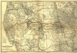
Pacific Railroad
$17.95 – $47.95
SKU: rrpr4
Related products
-

Winchester and Potomac Railroad Company
$17.95 – $47.95 -
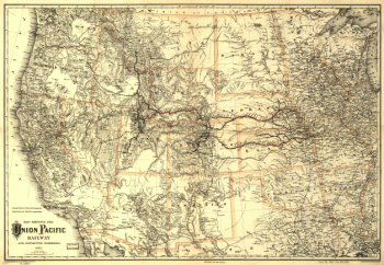
Union Pacific Railway Company
$17.95 – $47.95 -
Union Pacific Railway Company
$17.95 – $47.95 -
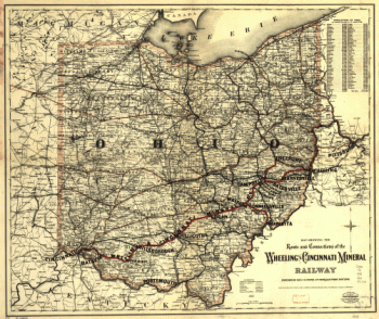
Wheeling and Cincinnati Mineral Railway
$17.95 – $47.95