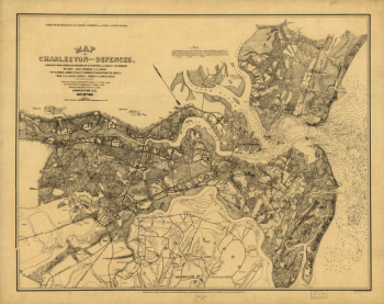
Entered according to Act of Congress in the year 1864 by D. N. Dobelmann & G. Huck.CREATED/PUBLISHED [S.l.], T. B. Usser, 1864. NOTES Scale ca. 1:170,000. Key to the map of Charleston Harbor and defences' is pasted to the right of the map. 'Green represents the Confederates' land [and] pink the Federal possessions' Indicates 'torpedoes in the channels,' obstructions, bridges, roads and streets, railroads, and rivers. Letters A to K represent fortifications, headquarters, depots, and 'place where Clarck of Brooklin was executed.' Forts and batteries are numbered 1 to 40. The number of guns and mortars for each is shown opposite the name given in the 'Key'

Charleston Harbor and city defences
$17.95 – $47.95
SKU: smsc34
Related products
-

Fort Sumter, South Carolina
$17.95 – $47.95 -
Map of Charleston and its defences
$17.95 – $47.95 -
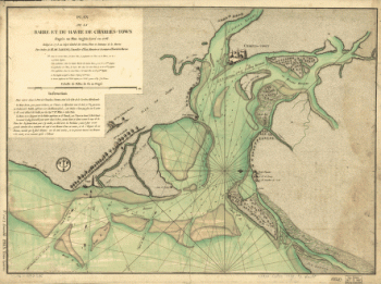
Plan de la barre et du havre de Charles-Town
$17.95 – $47.95