Together with its proposed branches, connections and extensions in Louisiana, Arkansas & Texas; also its connecting steamship routes from Berwicks Bay to ports in the Gulf of Mexico, together with the advantages in point of directness & diminished distance to the Pacific Coast, New Orleans, La. January 24th, 1859. Bayley, G. W. R. CREATED/PUBLISHED New Orleans, 1859. NOTES Scale 1:1,267,200. Outline map of the south-central states from Mississippi to the Rio Grande. Shows the 'Wheat Region of Texas.' Indicates completed, located and proposed lines. Table of distances in left side of map.

Map exhibiting the fixed location of the main trunk of the New-Orleans, Opelousas & Great Western Railroad of Louisiana
$17.95 – $47.95
SKU: smla35
Related products
-

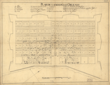
Plan de la Nouvelle Orleans / Anonymous.
$17.95 – $47.95 -
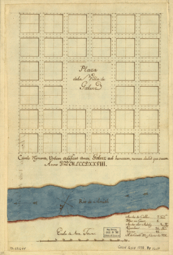
Plaza de la villa de Galvez.
$17.95 – $47.95 -
Port Hudson
$17.95 – $47.95